Datoteka:Mediterranean Sea political map-blank.svg

Veličina ovog PNG-pregleda ove SVG-datoteke: 800 × 585 piksela. Druge rezolucije: 320 × 234 piksela | 640 × 468 piksela | 1.024 × 749 piksela | 1.280 × 936 piksela | 2.560 × 1.872 piksela | 2.046 × 1.496 piksela.
Izvorna datoteka (SVG fajl, nominalno 2.046 × 1.496 piksela, veličina fajla: 1,06 MB)
Opis izmjene
| Opis |
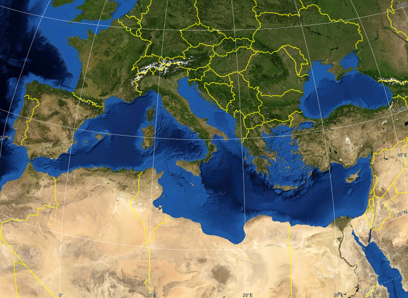
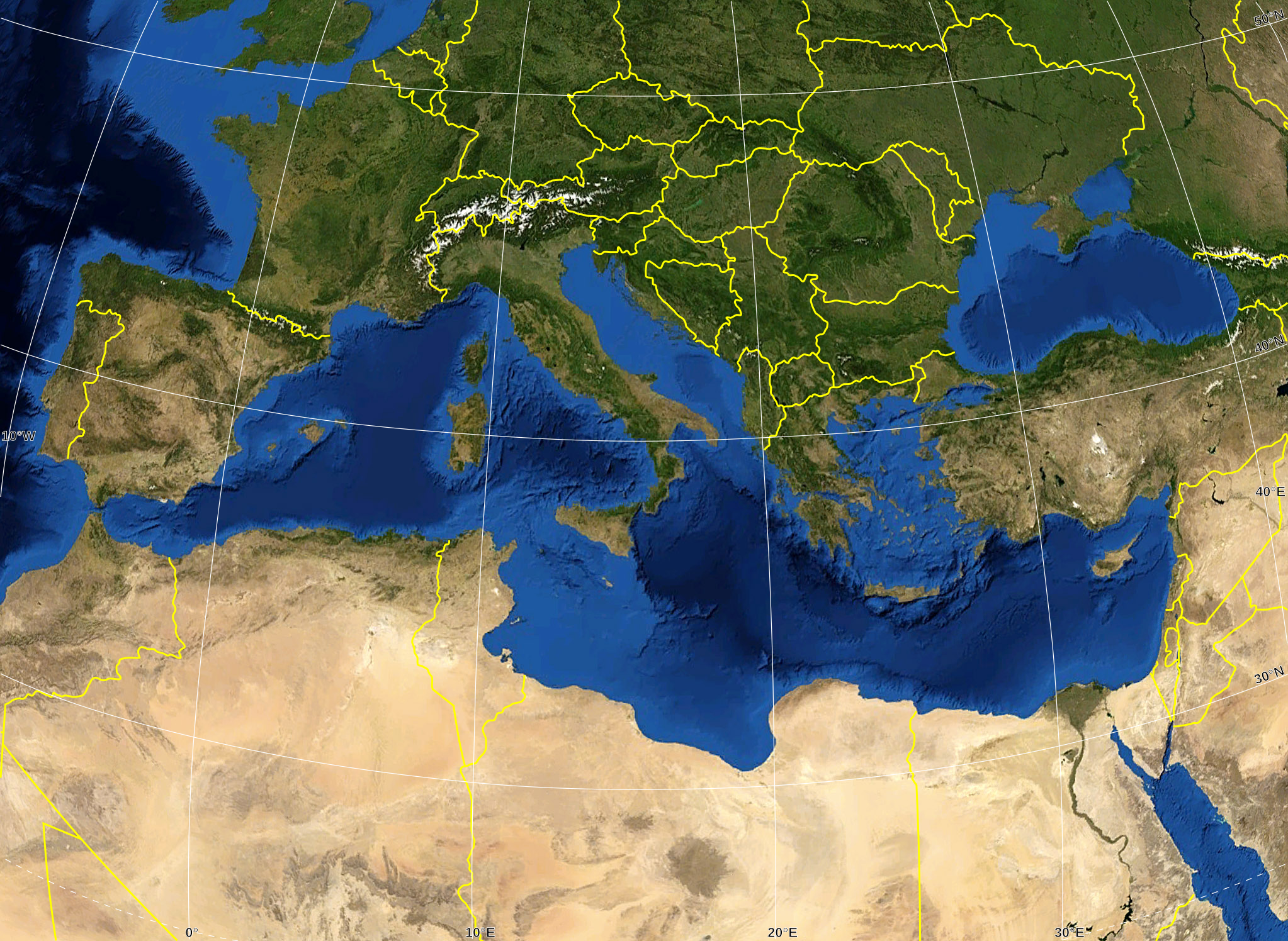
English: Blank map of the Mediterranean Sea, with the State borders.
Français : Carte vierge de la Mer Méditerranée avec les frontières nationales. |
| Datum | |
| Izvor |
Own work ; Raster background map : screenshot from NASA World Wind (Public Domain) |
| Autor | Eric Gaba (Sting - fr:Sting) |
| Dopuštenje (Ponovna upotreba ove datoteke) |
All rights released |
| Ostale verzije |
Derivative works of this file: Delian League Campaign Map.png
|


Licenciranje
| This image is in the public domain because it is a screenshot from NASA’s globe software World Wind using a public domain layer, such as Blue Marble, MODIS, Landsat, SRTM, USGS or GLOBE.
|
 |
| This work was previously under Public Domain, or a Free License. It has been digitally enhanced and/or modified. This derivative work has been (or is hereby) released into the public domain by its author, Sting at the French Wikipedia project. This applies worldwide. In some countries this is not legally possible; if so:
|
Historija datoteke
Kliknite na datum/vrijeme da biste vidjeli tadašnju verziju datoteke.
| Datum/vrijeme | Minijatura | Dimenzije | Korisnik | Komentar | |
|---|---|---|---|---|---|
| aktualna | 18:14, 19 maj 2008 | | 2.046 × 1.496 (1,06 MB) | Sting | "Tropic of Cancer" label correction |
| 03:07, 21 juni 2007 |  | 2.046 × 1.496 (1,06 MB) | Sting | {{Information |Description=Blank map of the Mediterranean Sea, with the State borders. |Source=Own work ;<br/>Background map : screenshot from NASA World Wind (Public Domain) |Date=June 2007 |Author=Eric Gaba ([[User:Sting|Sting] |
Upotreba datoteke
Nema stranica koje koriste ovu datoteku.
Globalna upotreba datoteke
Ovu datoteku upotrebljavaju i sljedeći projekti:
- Upotreba na projektu ar.wikipedia.org
- Upotreba na projektu fr.wikipedia.org
- Upotreba na projektu gv.wikipedia.org
- Upotreba na projektu id.wikipedia.org
- Upotreba na projektu pl.wiktionary.org