Datoteka:Map indicating Foxe Basin, Nunavut, Canada.png
Veća rezolucija nije dostupna.
Map_indicating_Foxe_Basin,_Nunavut,_Canada.png (360 × 330 piksela, veličina datoteke/fajla: 47 kB, MIME tip: image/png)
Opis izmjene
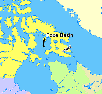
Map indicating Foxe Basin, Nunavut, Canada.
Nunavut
Greenland
Quebec
Newfoundland and Labrador
Manitoba
© Her Majesty the Queen in Right of Canada, Department of Natural Resources. All rights reserved.
Licence Agreement
Licenciranje

|
The copyright holder of this work allows anyone to use it for any purpose including unrestricted redistribution, commercial use, and modification.
Usage notes:
|
Historija datoteke
Kliknite na datum/vrijeme da biste vidjeli tadašnju verziju datoteke.
| Datum/vrijeme | Minijatura | Dimenzije | Korisnik | Komentar | |
|---|---|---|---|---|---|
| aktualna | 16:31, 21 mart 2006 | | 360 × 330 (47 kB) | David Kernow~commonswiki | == Summary == Map indicating Foxe Basin, Nunavut, Canada. {{legend|#ffff66|Nunavut}} {{legend|#ffffcc|Greenland}} {{legend|#d5fe94|Quebec}} {{legend|#ecebb6|Newfoundland and Labrador}} {{legend|#ccccff|Manitoba}} {{legend|#ffcccc|Ontario |
Upotreba datoteke
Sljedeća stranica koristi ovu datoteku:
Globalna upotreba datoteke
Ovu datoteku upotrebljavaju i sljedeći projekti:
- Upotreba na projektu ar.wikipedia.org
- Upotreba na projektu bs.wikipedia.org
- Upotreba na projektu ca.wikipedia.org
- Upotreba na projektu ceb.wikipedia.org
- Upotreba na projektu da.wikipedia.org
- Upotreba na projektu de.wikipedia.org
- Upotreba na projektu en.wikipedia.org
- Upotreba na projektu es.wikipedia.org
- Upotreba na projektu fi.wikipedia.org
- Upotreba na projektu fr.wikipedia.org
- Upotreba na projektu hr.wikipedia.org
- Upotreba na projektu hu.wikipedia.org
- Upotreba na projektu is.wikipedia.org
- Upotreba na projektu ja.wikipedia.org
- Upotreba na projektu nl.wikipedia.org
- Upotreba na projektu nn.wikipedia.org
- Upotreba na projektu no.wikipedia.org
- Upotreba na projektu pt.wikipedia.org
- Upotreba na projektu ro.wikipedia.org
- Upotreba na projektu sr.wikipedia.org
- Upotreba na projektu sv.wikipedia.org
- Upotreba na projektu www.wikidata.org
- Upotreba na projektu zh-min-nan.wikipedia.org
- Upotreba na projektu zh.wikipedia.org