Datoteka:East Germany 1956-1990.svg

Veličina ovog PNG-pregleda ove SVG-datoteke: 450 × 456 piksela. Druge rezolucije: 237 × 240 piksela | 474 × 480 piksela | 758 × 768 piksela | 1.011 × 1.024 piksela | 2.021 × 2.048 piksela.
Izvorna datoteka (SVG fajl, nominalno 450 × 456 piksela, veličina fajla: 474 kB)
Opis izmjene


.svg)
.svg)
.svg)
.svg)
.svg)


.svg)
.svg)
.svg)


.png)
.png)


.svg)


.svg)

.svg)


.svg)
.svg)
.svg)
.svg)


.svg)
.png)


.svg)


.svg)
.svg)


.svg)


.svg)


.svg)
.svg)
.svg)
.svg)
.svg)
.svg)
.svg)
_cropped.svg)
.svg)
.svg)
.svg)
.svg)
.svg)
.svg)
.svg)
.svg)
.svg)
.svg)
.svg)
.svg)
.svg)
.svg)
.svg)
.svg)
.svg)
.svg)
.svg)
.svg)
.svg)
.svg)
.svg)
.svg)
.svg)
.svg)
.svg)
.svg)
.svg)
.svg)
.svg)
.svg)
.svg)
.svg)
.svg)
.svg)
.svg)
.svg)
.svg)
.svg)
.svg)
.svg)
.svg)
.svg)
.svg)
| Ovo je retuširana slika, što znači da je digitalno izmjenjena u odnosu na svoju izvornu inačicu. Izmjene: '. Izvornik se može vidjeti ovdje: Blank map of Europe 1956-1990.svg.
|
Licenciranje
Ja, vlasnik autorskog prava ovog djela, ovdje ga objavljujem pod sljedećom licencom:
Ova datoteka dostupna je pod licencom Creative Commons Attribution-Share Alike 3.0 Unported licencom.
- Slobodno smijete:
- dijeliti – umnožavati, raspodjeljivati i prenositi djelo
- prerađivati – prilagođavati djelo
- Pod sljedećim uslovima:
- pripisivanje – Morate pripisati odgovarajuće autorske zasluge, osigurati link ka licenci i naznačiti jesu li napravljene izmjene. To možete uraditi na bilo koji razumni način, ali ne tako da se sugerira da davalac licence odobrava Vas ili Vašu upotrebu njegovog djela.
- dijeljenje pod istim uslovima – Ako mijenjate, transformišete ili nadograđujete ovaj materijal, morate ga objaviti i distribuirati samo pod istom ili sličnom licencom poput ove.
Izvorna evidencija postavljanja
This image is a derivative work of the following images:
- File:Blank_map_of_Europe_1956-1990.svg licensed with Cc-by-sa-3.0
- 2011-10-30T04:43:42Z Alphathon 450x456 (485146 Bytes) == {{int:filedesc}} == {{Information |Description={{en|Blank map of Europe showing national borders as they stood from 1956-1990.}} |Source=*[[:File:Blank_map_of_Europe.svg|]] |Date=2011-10-30 04:42 (UTC) |Author=*[[:File:Bla
Historija datoteke
Kliknite na datum/vrijeme da biste vidjeli tadašnju verziju datoteke.
| Datum/vrijeme | Minijatura | Dimenzije | Korisnik | Komentar | |
|---|---|---|---|---|---|
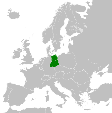
| aktualna | 02:33, 26 novembar 2011 | | 450 × 456 (474 kB) | StalwartUK | == {{int:filedesc}} == {{Information |Description={{en|Map of the East Germany (German Democratic Republic) as it was from 1949-1990. Surrounding countries accurate from 1956-1990.}} |Source=*[[:File:Blank_map_of_Europe_1956-1990.svg| |
Upotreba datoteke
Sljedeća stranica koristi ovu datoteku:
Globalna upotreba datoteke
Ovu datoteku upotrebljavaju i sljedeći projekti:
- Upotreba na projektu af.wikipedia.org
- Upotreba na projektu am.wikipedia.org
- Upotreba na projektu an.wikipedia.org
- Upotreba na projektu ar.wikipedia.org
- Upotreba na projektu ast.wikipedia.org
- Upotreba na projektu azb.wikipedia.org
- Upotreba na projektu az.wikipedia.org
- Upotreba na projektu ba.wikipedia.org
- Upotreba na projektu be.wikipedia.org
- Upotreba na projektu bs.wikipedia.org
- Upotreba na projektu ca.wikipedia.org
- Upotreba na projektu ce.wikipedia.org
- Upotreba na projektu cs.wikipedia.org
- Upotreba na projektu de.wikipedia.org
- Upotreba na projektu de.wiktionary.org
- Upotreba na projektu diq.wikipedia.org
- Upotreba na projektu el.wikipedia.org
- Upotreba na projektu en.wikipedia.org
- Upotreba na projektu en.wiktionary.org
- Upotreba na projektu eo.wikipedia.org
- Upotreba na projektu es.wikipedia.org
- Upotreba na projektu es.wiktionary.org
- Upotreba na projektu eu.wikipedia.org
- Upotreba na projektu ext.wikipedia.org
- Upotreba na projektu fa.wikipedia.org
- Upotreba na projektu fi.wikipedia.org
- Upotreba na projektu fr.wikipedia.org
- Upotreba na projektu fr.wiktionary.org
- Upotreba na projektu ga.wikipedia.org
- Upotreba na projektu gd.wikipedia.org
- Upotreba na projektu gl.wikipedia.org
- Upotreba na projektu gv.wikipedia.org
- Upotreba na projektu he.wikipedia.org
- Upotreba na projektu hi.wikipedia.org
- Upotreba na projektu hr.wikipedia.org
- Upotreba na projektu hr.wiktionary.org
- Upotreba na projektu hsb.wikipedia.org
- Upotreba na projektu hu.wikipedia.org
- Upotreba na projektu hy.wikipedia.org
- Upotreba na projektu ia.wikipedia.org
- Upotreba na projektu id.wikipedia.org
- Upotreba na projektu is.wikipedia.org
- Upotreba na projektu it.wikipedia.org