Datoteka:Dover UK locator map.svg

Veličina ovog PNG-pregleda ove SVG-datoteke: 800 × 561 piksela. Druge rezolucije: 320 × 225 piksela | 640 × 449 piksela | 1.024 × 719 piksela | 1.280 × 898 piksela | 2.560 × 1.796 piksela | 1.425 × 1.000 piksela.
Izvorna datoteka (SVG fajl, nominalno 1.425 × 1.000 piksela, veličina fajla: 1,18 MB)
| Opis | Equirectangular map projection on WGS 84 datum, with N/S stretched 160% |
| Datum | |
| Izvor |
|
| Autor | Nilfanion, created using Ordnance Survey data |
| Dopuštenje (Ponovna upotreba ove datoteke) |
Ova datoteka dostupna je pod licencom Creative Commons Attribution-Share Alike 3.0 Unported licencom. Pripisivanje: Contains Ordnance Survey data © Crown copyright and database right
|
Historija datoteke
Kliknite na datum/vrijeme da biste vidjeli tadašnju verziju datoteke.
| Datum/vrijeme | Minijatura | Dimenzije | Korisnik | Komentar | |
|---|---|---|---|---|---|
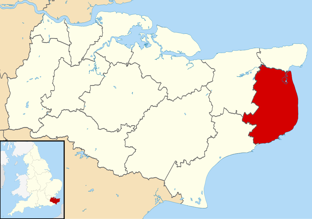
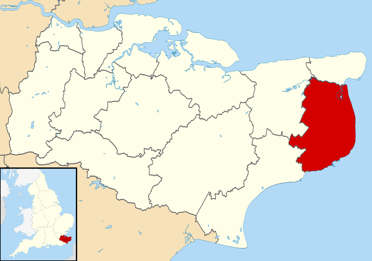
| aktualna | 11:07, 2 august 2011 | | 1.425 × 1.000 (1,18 MB) | Nilfanion | {{Information |Description=Map of Kent, UK with Dover highlighted. Equirectangular map projection on WGS 84 datum, with N/S stretched 160% |Source=Ordnance Survey [https://www.ordnancesurvey.co.uk/o |
Upotreba datoteke
Sljedeća stranica koristi ovu datoteku:
Globalna upotreba datoteke
Ovu datoteku upotrebljavaju i sljedeći projekti:
- Upotreba na projektu cy.wikipedia.org
- Upotreba na projektu en.wikipedia.org
- Dover
- Sandwich, Kent
- Walmer
- Eythorne
- Dover District
- East Langdon
- Deal, Kent
- Eastry
- Drellingore
- Kingsdown, Dover
- Maxton, Kent
- Martin, Kent
- Martin Mill
- Coombe, Kent
- Ash, Dover District
- West Langdon
- Wingham, Kent
- Barfrestone
- Kearsney, Kent
- Elvington, Kent
- Capel-le-Ferne
- Richborough
- Lydden
- Whitfield, Kent
- Alkham
- Ripple, Kent
- Aylesham
- Nonington
- Marley, Dover
- Temple Ewell
- Preston-next-Wingham
- River, Kent
- Shepherdswell
- Plucks Gutter
- Template:Towns and villages in Dover district
- St Margaret's at Cliffe
- Sholden
- Tilmanstone
- Buckland, Kent
- Staple, Kent
- Great Mongeham
- User:O1ive/Dover
- Goodnestone, Dover
- Woodnesborough
- Guston, Kent
- Stourmouth
- Ashley, Kent
- Coldred
- Denton, Kent