Datoteka:DeathValley L7 JuneJuly2000.jpg
Veličina ovog prikaza: 679 × 599 piksela. Druge rezolucije: 272 × 240 piksela | 544 × 480 piksela | 870 × 768 piksela | 1.160 × 1.024 piksela | 2.318 × 2.046 piksela.
Izvorna datoteka (2.318 × 2.046 piksela, veličina datoteke/fajla: 3,16 MB, MIME tip: image/jpeg)
Opis izmjene
| Opis |
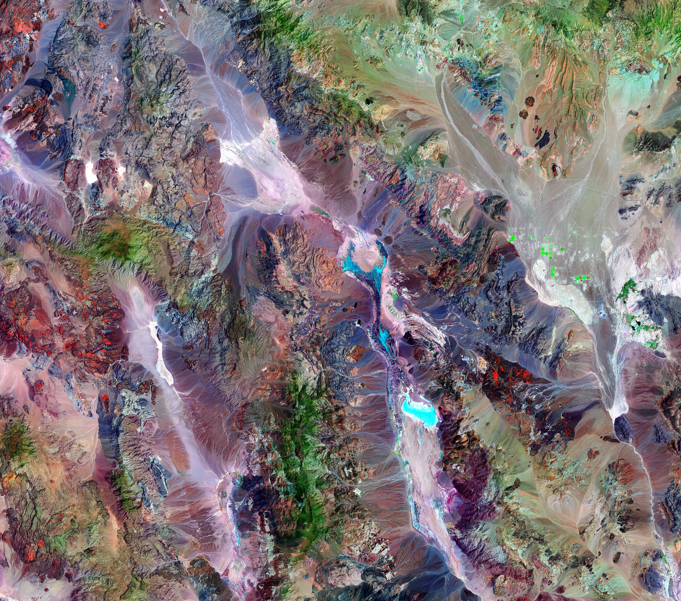
A thermal image compiled of two images taken by the Landsat 7 satellite of NASA. This image is of the Death Valley National Park's vegetation. As seen in the picture represented by the green coloring, the amount of vegetation increases as the altitude rises. Key- Green = Forest/Vegetation Rust/beige/brown = Bare ground Light blue = Salt pans with a little moisture Bright green = probably irrigation |
| Datum | juni 0011. and juli 0020., 2000 |
| Izvor | http://earthobservatory.nasa.gov/Newsroom/NewImages/images.php3?img_id=17247 |
| Autor | Landsat 7 satellite and Laura Rocchio, Landsat Project Science Office, using data provided courtesy of the Earth Satellite Corporation. |
| Dopuštenje (Ponovna upotreba ove datoteke) |
US government, public domain |
| Ostale verzije | en:Image:Death valley vegetation aerial view.jpg |
Licenciranje
| This file is in the public domain in the United States because it was solely created by NASA. NASA copyright policy states that "NASA material is not protected by copyright unless noted". (See Template:PD-USGov, NASA copyright policy page or JPL Image Use Policy.) | ||
 |
Warnings:
|
Historija datoteke
Kliknite na datum/vrijeme da biste vidjeli tadašnju verziju datoteke.
| Datum/vrijeme | Minijatura | Dimenzije | Korisnik | Komentar | |
|---|---|---|---|---|---|
| aktualna | 19:08, 27 april 2006 | | 2.318 × 2.046 (3,16 MB) | Holly Cheng | {{Information | Description=Landsat 7 imagery of w:Death Valley, California, USA. Green indicates vegetation, which increases with altitude. The varying shades of brown, beige, and rust indicate bare ground; the different colors result from varying mi |
Upotreba datoteke
Sljedeća stranica koristi ovu datoteku:
Globalna upotreba datoteke
Ovu datoteku upotrebljavaju i sljedeći projekti:
- Upotreba na projektu ar.wikipedia.org
- Upotreba na projektu en.wikipedia.org
- Upotreba na projektu sr.wikipedia.org
- Upotreba na projektu ur.wikipedia.org