Datoteka:Reigate and Banstead UK locator map.svg

Veličina ovog PNG-pregleda ove SVG-datoteke: 790 × 599 piksela. Druge rezolucije: 317 × 240 piksela | 633 × 480 piksela | 1.013 × 768 piksela | 1.280 × 971 piksela | 2.560 × 1.942 piksela | 1.425 × 1.081 piksela.
Izvorna datoteka (SVG fajl, nominalno 1.425 × 1.081 piksela, veličina fajla: 948 kB)
| Opis |
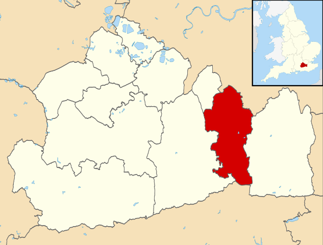
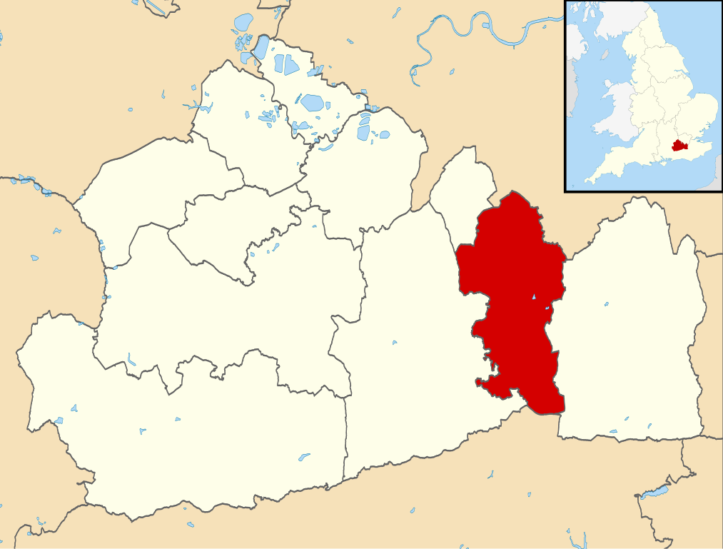
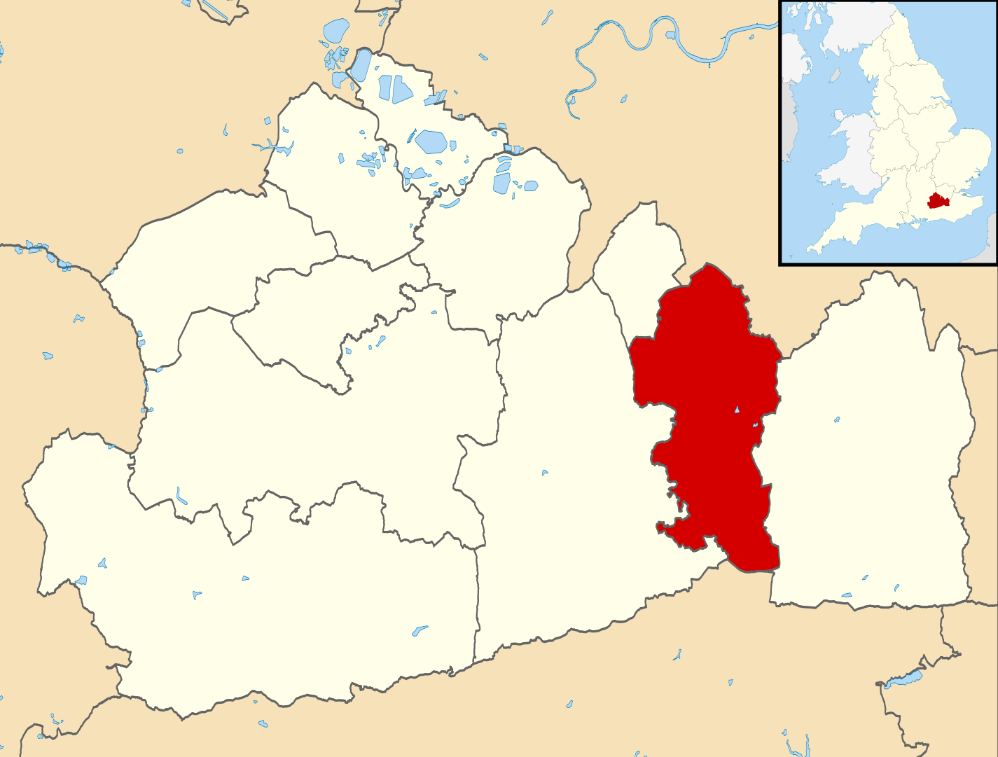
Map of Surrey, UK with Reigate and Banstead highlighted. Equirectangular map projection on WGS 84 datum, with N/S stretched 160% |
| Datum | |
| Izvor |
|
| Autor | Nilfanion, created using Ordnance Survey data |
| Dopuštenje (Ponovna upotreba ove datoteke) |
Ova datoteka dostupna je pod licencom Creative Commons Attribution-Share Alike 3.0 Unported licencom. Pripisivanje: Contains Ordnance Survey data © Crown copyright and database right
|
Historija datoteke
Kliknite na datum/vrijeme da biste vidjeli tadašnju verziju datoteke.
| Datum/vrijeme | Minijatura | Dimenzije | Korisnik | Komentar | |
|---|---|---|---|---|---|
| aktualna | 11:27, 2 august 2011 | | 1.425 × 1.081 (948 kB) | Nilfanion | {{Information |Description=Map of Surrey, UK with w:Reigate and Banstead highlighted. Equirectangular map projection on WGS 84 datum, with N/S stretched 160% |Source=Ordnance Survey [https://www.ordnancesurvey.co.u |
Upotreba datoteke
Sljedeća stranica koristi ovu datoteku:
Globalna upotreba datoteke
Ovu datoteku upotrebljavaju i sljedeći projekti:
- Upotreba na projektu cy.wikipedia.org
- Upotreba na projektu en.wikipedia.org
- Reigate and Banstead
- Reigate
- Redhill, Surrey
- Tadworth
- Royal Earlswood Hospital
- Reigate Grammar School
- Horley
- Merstham
- Banstead railway station
- Woodmansterne railway station
- Redhill railway station
- Merstham railway station
- Horley railway station
- Earlswood railway station (Surrey)
- Tattenham Corner railway station
- Walton-on-the-Hill
- Hooley
- Salfords
- Banstead
- Earlswood
- Meadvale
- Tattenham Corner
- Nork, Surrey
- Burgh Heath
- Kingswood, Surrey
- Banstead Athletic F.C.
- Chipstead F.C.
- Merstham F.C.
- Horley Town F.C.
- Redhill F.C.
- Kingswood railway station
- Lower Kingswood
- Chipstead, Surrey
- South Park F.C.
- Aberdour School
- Reigate railway station
- Redhill Aerodrome
- St Bede's School
- Chipstead railway station
- Reigate Priory F.C.
- Woodmansterne
- Royal Alexandra and Albert School
- Reigate Priory
- Priory Preparatory School
- Chipstead Downs
- Reigate College
- Reigate School
- East Surrey College
- Netherne-on-the-Hill